By Will Ferguson, College of Arts & Sciences
 VANCOUVER, Wash. – Washington State University scientists Stephen Henderson and Nikolay Strigul have developed a computer model that uses photographs to recreate the complex geometry of coastal plants.

“A large and growing percentage of Earth’s human population lives at low elevations along coastlines,” said Henderson, an associate professor in the School of the Environment at WSU Vancouver. “Developing a better understanding of the sheltering effects of aquatic vegetation on these environments will help us identify areas at risk from climate change and in the design of solutions to future problems.”
The research more efficiently gathers input for models that determine the effectiveness of mangrove forests, seagrass beds and other coastal plants at depositing sediment and reducing flooding and erosion. This could eventually help scientists predict how rising seas and more frequent extreme weather events will affect coastal population centers impacted by climate change.
The work was performed in collaboration with scientists from the University of Waikato (New Zealand) and the U.S. Forest Service. It is published in the September edition of Estuarine, Coastal, and Shelf Sciences (https://www.sciencedirect.com/science/article/pii/S0272771416301482).
Protecting coastlines and people
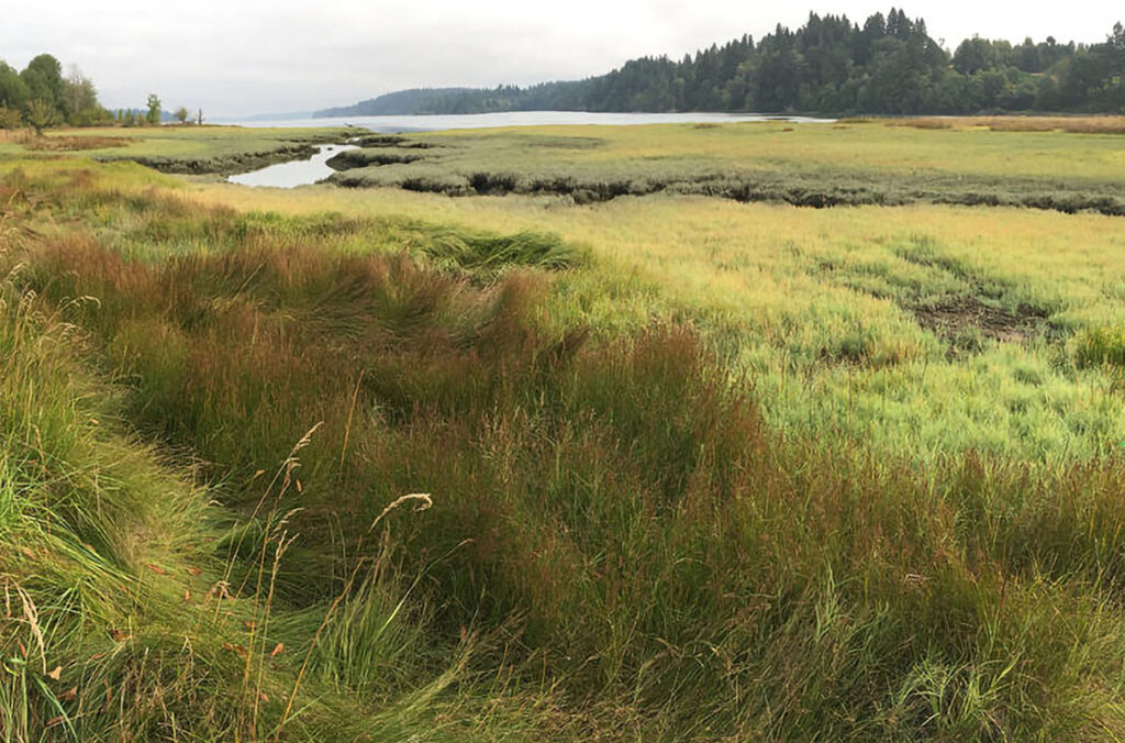
Coastal zones account for four percent of Earth’s land surface but are home to one third of the planet’s human population.

Aquatic vegetation in shallow tidal waters accrues nutrient-rich sediments for growing food and protects coastlines from sea level rise, erosion and storms by dissipating the impact of waves. In order to predict the sheltering effects of coastal plants, scientists need to be able to quantify the geometry of roots and branches that disperse water.
Until recently, the only way to do this was to send large groups of human workers into often tropical and swamp-like conditions to trudge through deep mud and get measurements of foliage using handheld calipers.
Henderson approached Strigul, an assistant professor of mathematics at WSU Vancouver and an expert in plant and tree modeling, to see if they could replace the century-old manual labor method with technology.
Accurate models reflect complex detail

Strigul and mathematics postdoctoral researcher Jean Liénard altered a computer modeling approach they originally developed for creating three dimensional representations of land-based forests. They used it to model stands of mangrove trees in Vietnam’s Mekong Delta, where Henderson works with local researchers.

The new approach requires a small team of scientists to take photographs of a section of mangrove forest from multiple viewpoints with a handheld camera. The photos are fed into a computer program that uses triangulation of key features in different images to make a three dimensional representation of the area down to a few millimeters in accuracy.
When compared to manual measurements of mangrove roots, Henderson and Strigul’s new technique takes less time, is at least as accurate and can resolve the complex dimensions of roots encrusted with barnacles, a task not possible by hand.
“Basically, we were able to replace hundreds of student workers with one camera and new modeling technology that has only been in existence for a few years,” Strigul said. “By substantially reducing measurement time in the field, our approach has the potential to improve hydrodynamic models. And it can more readily be scaled up to create simulations of water flow through aquatic vegetation along entire coastlines.”
Contacts:
Stephen Henderson, WSU Vancouver School of the Environment, 360-546-9268, steve_henderson@wsu.edu
Nikolay Strigul, WSU Vancouver Department of Mathematics and Statistics, 201-952-4260, nick.strigul@wsu.edu